方案详情文
智能文字提取功能测试中
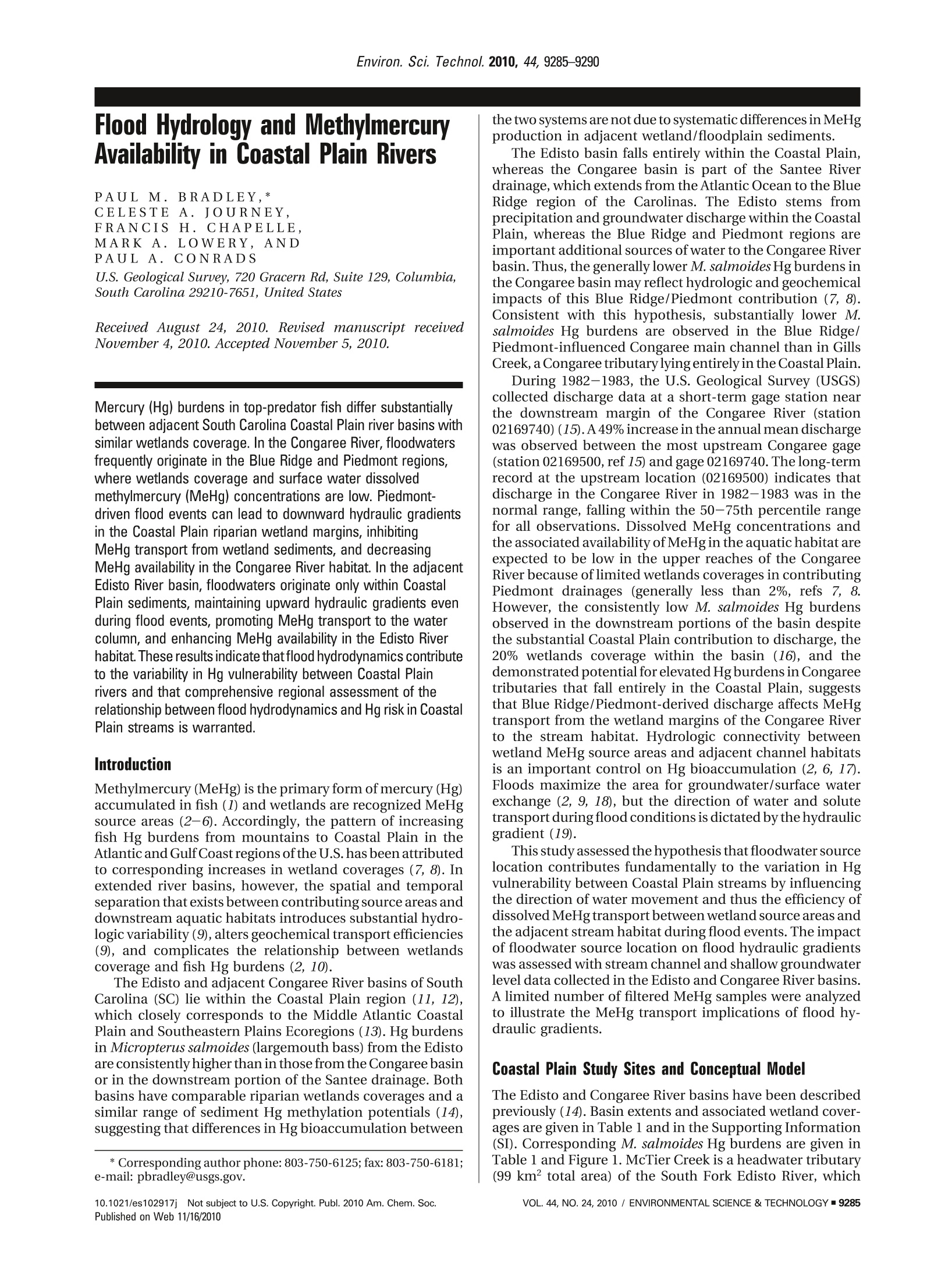
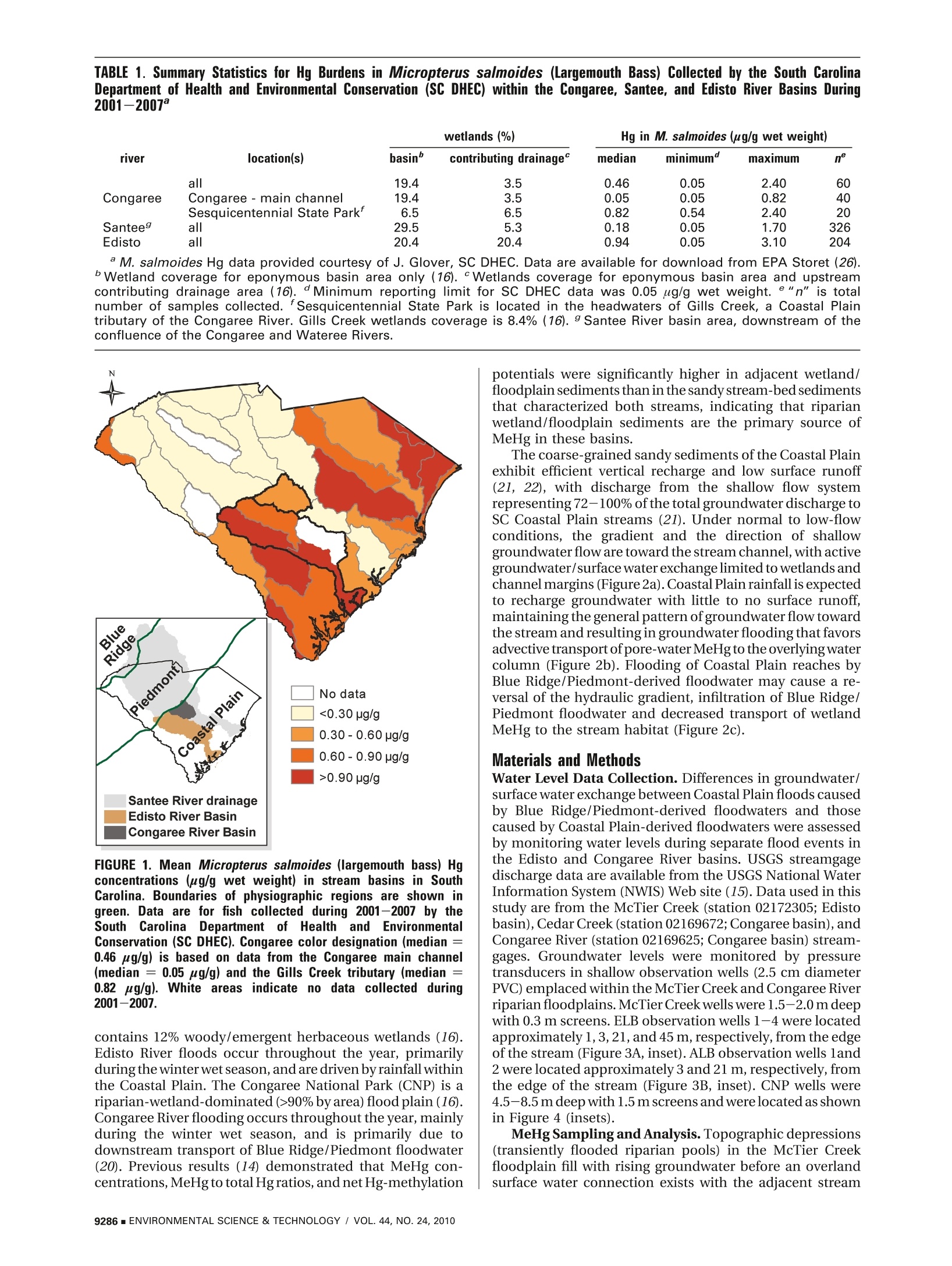
Environ. Sci. Technol. 2010, 44, 9285-9290 Flood Hydrology and MethylmercuryAvailability in Coastal Plain Rivers PAULM.BRADLEY,* CELESTEA.JOURNEY,FRANCISH.CHAPELLE,MARK A. LOWERY,ANDPAULA.CONRADS U.S. Geological Survey, 720 Gracern Rd, Suite 129, Columbia,South Carolina 29210-7651, United States Received August 24, 2010. Revised manuscript receivedNovember 4, 2010. Accepted November 5, 2010. Mercury (Hg) burdens in top-predator fish differ substantiallybetween adjacent South Carolina Coastal Plain river basins withsimilar wetlands coverage. In the Congaree River, floodwatersfrequently originate in the Blue Ridge and Piedmont regions,where wetlands coverage and surface water dissolvedmethylmercury (MeHg) concentrations are low. Piedmont-driven flood events can lead to downward hydraulic gradientsin the Coastal Plain riparian wetland margins, inhibitingMeHg transport from wetland sediments, and decreasingMeHg availability in the Congaree River habitat. In the adjacentEdisto River basin, floodwaters originate only within CoastalPlain sediments, maintaining upward hydraulic gradients evenduring flood events, promoting MeHg transport to the watercolumn, and enhancing MeHg availability in the Edisto Riverhabitat. These results indicate thatflood hydrodynamics contributeto the variability in Hg vulnerability between Coastal Plainrivers and that comprehensive regional assessment of therelationship between flood hydrodynamics and Hg risk in CoastalPlain streams is warranted. Introduction Methylmercury (MeHg) is the primary form of mercury (Hg)accumulated in fish (1) and wetlands are recognized MeHgsource areas (2-6).Accordingly, the pattern of increasingfish Hg burdens from mountains to Coastal Plain in theAtlantic and Gulf Coast regions ofthe U.S. has been attributedto corresponding increases in wetland coverages (7, 8). Inextended river basins, however, the spatial and temporalseparation that exists between contributing source areas anddownstream aquatic habitats introduces substantial hydro-logic variability (9), alters geochemical transport efficiencies(9), and complicates the relationship between wetlandscoverage and fish Hg burdens (2, 10). The Edisto and adjacent Congaree River basins of SouthCarolina (SC) lie within the Coastal Plain region (11, 12),which closely corresponds to the Middle Atlantic CoastalPlain and Southeastern Plains Ecoregions (13). Hg burdensin Micropterus salmoides (largemouth bass) from the Edistoare consistently higher than in those from the Congaree basinor in the downstream portion of the Santee drainage. Bothbasins have comparable riparian wetlands coverages and asimilar range of sediment Hg methylation potentials (14),suggesting that differences in Hg bioaccumulation between ( * Corresponding author phone:803-750-6125; fax:803-750-6181; e-mail: pbradley@usgs.gov. ) the two systems are not due to systematic differences in MeHgproduction in adjacent wetland/floodplain sediments. The Edisto basin falls entirely within the Coastal Plain,whereas the Congaree basin is part of the Santee Riverdrainage, which extends from the Atlantic Ocean to the BlueRidge region of the Carolinas. The Edisto stems fromprecipitation and groundwater discharge within the CoastalPlain, whereas the Blue Ridge and Piedmont regions areimportant additional sources of water to the Congaree Riverbasin. Thus, the generally lower M. salmoides Hg burdens inthe Congaree basin may reflect hydrologic and geochemicalimpacts of this Blue Ridge/Piedmont contribution (7, 8).Consistent with this hypothesis, substantially lower M.salmoides Hg burdens are observed in the Blue Ridge/Piedmont-influenced Congaree main channel than in GillsCreek, a Congaree tributary lying entirely in the Coastal Plain.During 1982-1983, the U.S. Geological Survey (USGS)collected discharge data at a short-term gage station nearthe downstream margin of the Congaree River (station02169740) (15).A49%increase in the annual mean dischargewas observed between the most upstream Congaree gage(station 02169500, ref 15) and gage02169740.The long-termrecord at the upstream location (02169500) indicates thatdischarge in the Congaree River in 1982-1983 was in thenormal range, falling within the 50-75th percentile rangefor all observations. Dissolved MeHg concentrations andthe associated availability of MeHg in the aquatic habitat areexpected to be low in the upper reaches of the CongareeRiver because of limited wetlands coverages in contributingPiedmont drainages (generally less than 2%, refs 7, 8.However, the consistently low M. salmoides Hg burdensobserved in the downstream portions of the basin despitethe substantial Coastal Plain contribution to discharge, the20% wetlands coverage within the basin (16), and thedemonstrated potential for elevated Hg burdens in Congareetributaries that fall entirely in the Coastal Plain, suggeststhat Blue Ridge/Piedmont-derived discharge affects MeHgtransport from the wetland margins of the Congaree Riverto the stream habitat. Hydrologic connectivity betweenwetland MeHg source areas and adjacent channel habitatsis an important control on Hg bioaccumulation (2, 6, 17).Floods maximize the area for groundwater/surface waterexchange (2, 9, 18), but the direction of water and solutetransport during flood conditions is dictated by the hydraulicgradient (19). This study assessed the hypothesis that floodwater sourcelocation contributes fundamentally to the variation in Hgvulnerability between Coastal Plain streams by influencingthe direction of water movement and thus the efficiency ofdissolved MeHg transport between wetland source areas andthe adjacent stream habitat during flood events. The impactof floodwater source location on flood hydraulic gradientswas assessed with stream channel and shallow groundwaterlevel data collected in the Edisto and Congaree River basins.A limited number of filtered MeHg samples were analyzedto illustrate the MeHg transport implications of flood hy-draulic gradients. Coastal Plain Study Sites and Conceptual Model The Edisto and Congaree River basins have been describedpreviously (14). Basin extents and associated wetland cover-ages are given in Table 1 and in the Supporting Information(SI). Corresponding M. salmoides Hg burdens are given inTable l and Figure 1. McTier Creek is a headwater tributary(99 km’ total area) of the South Fork Edisto River, which TABLE 1. Summary Statistics for Hg Burdens in Micropterus salmoides (Largemouth Bass) Collected by the South CarolinaDepartment of Health and Environmental Conservation (SC DHEC) within the Congaree, Santee, and Edisto River Basins During2001-2007° river location(s) basin" contributing drainage° median minimum° maximum n all 19.4 0.46 0.05 2.40 Congaree Congaree -main channel 19.4 0.05 0.05 0.82 Sesquicentennial State Park' 6.5 0.82 0.54 2.40 Santee 29.5 0.18 0.05 1.70 326 Edisto 20.4 20.4 0.94 0.05 3.10 204 M. salmoides Hg data provided courtesy of J. Glover, SC DHEC. Data are available for download from EPA Storet (26). Wetland coverage for eponymous basin area only (16). Wetlands coverage for eponymous basin area and upstreamcontributing drainage area (16).Minimum reporting limit for SC DHEC data was 0.05 pg/g wet weight. e "n" is totalnumber of samples collected. fSesquicentennial State Park is located in the headwaters of Gills Creek, a Coastal Plaintributary of the Congaree River. Gills Creek wetlands coverage is 8.4%(16). 9 Santee River basin area, downstream of theconfluence of the Congaree and Wateree Rivers. FIGURE 1. Mean Micropterus salmoides (largemouth bass) Hgconcentrations (ug/g wet weight) in stream basins in SouthCarolina. Boundaries of physiographic regions are shown ingreen. Data are for fish collected during 2001-2007 by theSouthCarolinai Department ofHealthhandEnvironmentalConservation (SC DHEC). Congaree color designation (median =0.46 ug/g) is based on data from the Congaree main channel(median = 0.05 ug/g) and the Gills Creek tributary (median =0.82 ug/g). White areas indicate no data collected during2001-2007. contains 12% woody/emergent herbaceous wetlands (16).Edisto River floods occur throughout the year, primarilyduring the winter wet season, and are driven by rainfall withinthe Coastal Plain. The Congaree National Park (CNP) is ariparian-wetland-dominated (>90% by area) flood plain (16).Congaree River flooding occurs throughout the year, mainlyduring the winter wet season, and is primarily due todownstream transport of Blue Ridge/Piedmont floodwater(20). Previous results (14) demonstrated that MeHg con-centrations, MeHg to total Hg ratios, and netHg-methylation potentials were significantly higher in adjacent wetland/floodplain sediments than in the sandy stream-bed sedimentsthat characterized both streams, indicating that riparianwetland/floodplain sediments are the primary source ofMeHg in these basins. The coarse-grained sandy sediments of the Coastal Plainexhibit efficient vertical recharge and low surface runoff(21, 22), with discharge from the shallow flow systemrepresenting 72-100% of the total groundwater discharge toSC Coastal Plain streams (21). Under normal to low-flowconditions, the gradient and the direction of shallowgroundwater flow are toward the stream channel, withactivegroundwater/surface water exchangelimited to wetlands andchannel margins (Figure2a). Coastal Plain rainfall is expectedto recharge groundwater with little to no surface runoff,maintaining the general pattern of groundwater flow towardthe stream and resulting in groundwater flooding that favorsadvective transport of pore-water MeHg to the overlying watercolumn (Figure 2b). Flooding of Coastal Plain reaches byBlue Ridge/Piedmont-derived floodwater may cause a re-versal of the hydraulic gradient, infiltration of Blue Ridge/Piedmont floodwater and decreased transport of wetlandMeHg to the stream habitat (Figure 2c). Materials and Methods Water Level Data Collection. Differences in groundwater/surface water exchange between Coastal Plain floods causedby Blue Ridge/Piedmont-derived floodwaters and thosecaused by Coastal Plain-derived floodwaters were assessedby monitoring water levels during separate flood events inthe Edisto and Congaree River basins. USGS streamgagedischarge data are available from the USGS National WaterInformation System (NWIS) Web site (15). Data used in thisstudy are from the McTier Creek (station 02172305; Edistobasin), Cedar Creek (station 02169672; Congaree basin), andCongaree River (station 02169625; Congaree basin) stream-gages. Groundwater levels were monitored by pressuretransducers in shallow observation wells (2.5 cm diameterPVC) emplaced within the McTier Creek and Congaree Riverriparian floodplains. McTier Creek wells were 1.5-2.0 m deepwith 0.3 m screens.ELB observation wells 1-4 were locatedapproximately 1,3, 21, and45 m, respectively, from the edgeof the stream (Figure 3A, inset). ALB observation wells land2 were located approximately3 and21 m, respectively, fromthe edge of the stream (Figure 3B, inset). CNP wells were4.5-8.5 m deep with 1.5 m screens andwere located as shownin Figure 4 (insets). MeHg Sampling and Analysis. Topographic depressions(transiently flooded riparian pools) in the McTier Creekfloodplain fill with rising groundwater before an overlandsurface water connection exists with the adjacent stream FIGURE 2. Conceptual model of groundwater/surface waterhydrodynamics in Coastal Plain river basins under (a) low tonormal flow conditions, (b) flood conditions driven by CoastalPlain precipitation, and (c) flood conditions caused by down-stream transport of Piedmont floodwater. channel.These pools provided a means of assessing the MeHgsignature of groundwater discharging through the floodplainsediment. To illustrate the MeHg transport implications ofthe groundwater flood mechanism, filtered MeHg (FMeHg)concentrations in a riparian pool located next to transectELB and in the adjacent stream were assessed eight times atthe McTier Creek study site during 2007-2009. Additionalsamples were collected without accompanying water levelmonitoring at locations throughout the McTier Creek basinto assess the representativeness of the FMeHg data at ELB.Toillustrate the comparativelylowMeHg signature associatedwith Blue Ridge/Piedmont-derived floodwater, FMeHg con-centrations were assessed during a flood event in November2009 at single locations in the Saluda and Broad Rivers andfourlocations in the Congaree River adjacent to andupstreamfrom the CNP. In all cases, USGS ultra trace-level clean-sampling procedures (23) were used to collect surface watersamples. Processing (4, 23) and analysis (24) of FMeHg. samples were as described. Results and Discussion Hydrodynamic Differences in Coastal Plain-Driven andBlue Ridge/Piedmont-Driven Floods. The groundwater floodpattern depicted in Figure 2b was hypothesized to predomi-nate in the Edisto River, because the Edisto is containedentirely in the Coastal Plain. Water level data collected fromlocations within the McTier Creek basin support thishypothesis. Figure 3A presents groundwater level changes 2009 FIGURE 3. Example of water level gradient profiles observedduring seasonal floodd6events at the (A) ELB and (B) ALBgroundwater well transects in the McTier Creek sub-basin ofthe Edisto River basin. Locations of monitoring wells relative toMcTier Creek are shown in the insets. The gray area in theELB inset indicates the approximate extent and location of thetransiently flooded riparian pool in transect ELB, which is located less than 100 m upstreamfrom theMcTier Creek at New Holland streamgage (02172305)and extends inland in increasing numerical order. Prior toflooding the gradient at ELB was approximately 0.3 m fromELB-4 toward McTier Creek. Approximately 4 h after rainfallbegan,stream and groundwaterlevels began rising essentiallysimultaneously, indicating good hydrologic connectivitybetween the stream and inland groundwater locations. Atthe onset, peak, and end of flood conditions the groundwatergradient was upward and toward the stream, indicatingdischarge of groundwater from the sediment to the overlyingwater column at all well locations. There was no discerniblegroundwater gradient between well locations during flooding,but a clear gradient was observed from ELB-1 toward thestream throughout flood conditions. A similar pattern wasobserved at the upstream ALB transect (Figure 3B). Because the Congaree River is a part of the Santee Riverdrainage and frequently flooded by Blue Ridge/Piedmont-derived water, the flood pattern depicted in Figure 2c washypothesized to occur. Water level data collected fromlocations within the CNP during a 2004 flood event supportthis hypothesis. Precipitation occurred in the SC Piedmontand upper Coastal Plain. Flooding occurred after precipitationended as the result of downstream transport of Piedmontfloodwater. Prior to flooding, the gradient between well RIC-346 and Cedar Creek at station 02169672 was generally low(Figure 4A). Groundwater levels at RIC-346 were approxi-mately 1.5 m below land surface at the onset of floodconditions and more than 2m below floodwater levels at the FIGURE 4. Example of water level gradient profiles observedduring seasonal flood events at the (A) Cedar Creek and (B)Congaree River locations in the Congaree National Park. Loca-tions of monitoring wells relative to Cedar Creek and the Con-garee River are shown in the insets. peak of flooding, demonstrating a downward (away fromthe stream) gradient throughout. The rapid rise in ground-water level following the onset of flood conditions indicatedvertical infiltration of floodwaters. This pattern was repeateda few days later (Figure 4A). The water level in the Congaree River began rising rapidlyon September 7th (Figure4B). The levee area at RIC-701 wasovertopped on September 9th (Figure 4A). Water levels inRIC-701 rose rapidly as the result of lateral recharge evenbefore flooding occurred, but still were more than 1 m belowland surface at the onset of flood conditions. At peak flood,groundwater levels in RIC-701 remained below land surfaceand approximately 0.5 m below flood levels. Throughouttheflood period the gradient remained downward (away fromthe stream) at RIC-701. RIC-342 is located inland from the Congaree River andthe levee deposits that line the main channel (Figure 4B).Until the river stage overtops the intervening levee system,floodwaters move slowly inland via local breaks in the leveedeposits and a network of small drainage features. Im-mediately after the levee was overtopped on Sept 10thgroundwater levels in RIC-342 rose rapidly, indicating thearrival and downward infiltration of floodwater into theshallow subsurface. At peak flood, groundwater levels in RIC-342 remained 0.5 m below flood levels. Throughout the floodperiod the gradient remained downward (away from thestream) at RIC-342. The hydraulic gradient changed backtoward the stream by September 24th, well after floodconditions had ended. Implications for MeHg Transport in Edisto and CongareeSystems. The hydrologic pattern observed in the McTierCreek sub-basin of the Edisto River system is consistent withcontinuous discharge of groundwater from the shallowsubsurface toward the stream channel habitat even during Channel Pools FIGURE 5. Filtered MeHg concentrations (ng/L) observed in theMcTier Creek study area during 2007-2009. (A) FMeHg in atransient riparian pool near ELB and in the adjacent McTierCreek channel. “Dry" indicates no standing water. (B) FMeHgin stream channel and in wetland/riparian pool samples through-out the McTier Creek study area. Box indicates the 25-75%quartile range. Center line indicates median. Whiskers indicatethe data range. “n" is the number of samples. Different lettersindicate statistically significant differences (p <0.0001;Kruskal-Wallis and Tukey's HSD). flood conditions. This type of response favors transport ofMeHg from the subsurface source area to the stream channelhabitat. To illustrate, a limited number of FMeHg sampleswere collected from a shallow depression in the McTier Creekfloodplain near the ELB water level monitoring transect.These floodplain depressions are inundated by rising ground-water before flooding creates an overland connection to thestream and provide an opportunity to assess MeHg indischarging groundwater prior to the mixing with stream-channel surface water that occurs during flood conditions.This floodplain depression was assessed eight times during2007-2009 (Figure 5A). On the five occasions that standingwater was present, no overland connection to McTier Creekexisted and the antecedent conditions of the surroundingfloodplain varied from dry (November 2007, March 2008,April 2008), flood recession 1 day prior to sampling (une2007), and flood recession 3 days prior to sampling (July2009). In every instance the FMeHg concentrations observedin the pool were greater than were measured in the adjacentstream channel, with concentrations ranging from ap-proximately two times higher in June 2007 to greater than10 times higher in July 2009. The pattern of discharginggroundwater and statistically greater FMeHg concentrationsin floodplain locations was observed throughout the McTierCreek basin in 2007-2009 (Figure 5B). In contrast, the hydrologic characteristics of the Congareebasin favor low FMeHg concentrations and, consequently,reduced availability for biotic uptake and accumulation inthe main channel aquatic habitat. TheFMeHg concentrationsobserved in the Congaree flood in November 2009 were low,consistent with the comparatively low wetlands coverage ofthe upstream Blue Ridge/Piedmont drainages (16) andindicating lower MeHg availability within the Congaree Riverchannel habitat. Implications for MeHg Bioaccumulation in Coastal PlainStates. The results of this study support the hypothesis thatcharacteristically coarse-grained sediments of the SC CoastalPlain favor efficient exchange of water between streams andshallow groundwater systems. This characteristic creates apotential for efficient transport of MeHg from wetland/floodplain source areas to the stream habitat and, conse-quently, an inherent vulnerability to Hg bioaccumulation inCoastal Plain streams. In this setting, the direction of watermovement across the sediment/water interface during highflow periods, in which hydrologic connectivity between thestream and the wetland/floodplain sediments is maximized,appears to be a critical control on MeHg exchange betweensaturated-sediment source areas andadjacent surface waterhabitats and, ultimately, on the potential for Hg bioaccu-mulation. The results of this study indicate that flood eventsattributable to precipitation within the SC Coastal Plain aredriven by groundwater discharge, promoting transfer ofMeHg from wetland porewater to the stream habitat. Incontrast, Coastal Plain floods caused by external flood eventsdeliver water with low dissolved MeHg concentrations andreverse the direction of groundwater/surface water exchange,inhibiting MeHg transport from the wetland porewater tothe stream and reducing MeHg availability in the streamhabitat. This hydrologic context suggests that stream systems, likethe Edisto River, are particularly vulnerable to H1gg bb1i0o:accu-mulation, because they lie entirely or largely within theCoastal Plain and are primarily subject to groundwaterflooding. In contrast, Coastal Plain stream reaches (like theCongaree River) which are subject to both groundwater floodand external floodwater events, are expected to exhibitreduced MeHg availability, depending on the relative fre-quency of the two mechanisms. Flood events in the CongareeRiver main channel are predominately due to Blue Ridge/Piedmont floodwaters that exhibit low dissolved MeHgconcentrations and lead to low mean Hg burdens in M.salmoides in the Congaree and downstream Santee River,consistent with our conceptual model. Because the Coastal Plain region extends along the Atlanticand Gulf Coasts of the United States from New Jersey toTexas, the results of this limited study may have regional-scaleimplications for Hg bioaccumulation. The fundamentalhydrologic characteristics of the SC Coastal Plain are common Acknowledgments This research was supported by the Toxic SubstancesHydrology Program, National Park Service Research Partner-ship,and National Water Quality Assessment Program of theU.S. Geological Survey and the South Carolina Departmentof Health and Environmental Control (SC DHEC). M.salmoides Hg data were provided by J. Glover of SC DHEC.The investigators would like to thank the family of SenatorStrom Thurmond and the National Park Service for accessto the McTier Creek and Congaree National Park study areas,respectively. The use of trade, product, or firm names in thispaper is for descriptive purposes only and does not implyendorsement by the U.S. Government. The November 2007 sample at ELB provides particular in the Coastal Plain region and a similar relationship betweeninsightinto the MeHg signature associated with groundwaterflood hydrodynamics and Hg bioaccumulation is expecteddischarging through the floodplain land surface (Figure 5A).throughout. In a recent USGS national survey of Hg burdensA localized rainfall event the day before sample collectionin high trophic level piscivores (25), Scudder et al. reportedresulted in rising groundwater and streamwater levels.an elevated incidence of high top predator fish Hg burdensDischarging groundwater partially filled the previously dryin stream reaches along the Atlantic and Gulf Coasts thatdepression but did not overtop the floodplain. Dissolvedcorresponded closely to the Coastal Plain region. Thisoxygen concentrations, measured in the pool during MeHgobservation supports the conclusion that flood hydrody-sample collection in 2007-2009, ranged from 2 to 5 mg/L,namics contribute to an increased vulnerability to Hgindicating that redox conditions did not favor Hg methylationbioaccumulation in Coastal Plain rivers and indicates thatin the standing water. Thus, because the pool and thea more comprehensive regional assessment of the relation-surrounding fl(99oodplain were dry less than 12 h prior to sampleship between flood hydrodynamics and Hg risk in Coastalcollection, the November 2007 sample reflects the immediatePlain streams is warranted.transport ofMeHg into the surface water compartment. Theseresults demonstrate that the groundwater flood mechanismcan efficiently transfer floodplain MeHg to the surface watercompartment Supporting Information Available Basin maps, FMeHg sampling/analysis details and results,and a conceptual model of McTier Creek groundwater/surface water hydrodynamics. This material is available freeof charge via the Internet at http://pubs.acs.org. Literature Cited ( ( 1) Bloom, N. S. O n the chemical f o rm of mercury in edible fish and marine in v ertebrate tissue. Ca n . J. Fish.Aquat. Sci . 1992, 49,1010-1017.http://article.pubs.nrc-cnrc.gc.ca/RPAS/rpv?hm=HInit&journal=cjfas&volume=49&calyLang=eng&afpf=f92- 113.pdf. ) ( (2 ) Ward, D.; Nislow, K . ; F olt, C. B ioaccumulation s y ndrome: Identifying factors that make some stream food webs prone toelevated mercury bioaccumulation. Ann.N.Y. Ac a d. Sci. 2010, 1 195, 1 , 62- 8 3, DOI: 10.1111/j.1749-6632.2010.05456.x. ) ( (3) Hall, B.; Aiken , G.; Krabbenhoft, D.; Marvin-DiPasquale, M.; Swarzenski, C. Wetlands as principal zones of methylmercury production in southern Louisiana and the Gulf ofMexico region. Environ. Pollut.2008,1 5 4(1), 124-134. ) ( (4 ) B righam, M. E. ; Wentz, D. A. ; Aiken, G. R. ; Krabbenhoft, D. P . Mercury c ycling in stream e cosystems. 1. W ater columnchemistry and t r ansport. E n viron. S c i. T e chnol.20 0 9, 43 , 8, 2720-2725, D OI: 1 0.1021/es802694n. ) ( (5 G ) r igal, D . F . Inputs and outputs of m ercury from t e rrestrial watersheds: a review. E nviron. Rev. 2002, 10, 1 -39. ) (6) St.Louis, V. L.; Rudd, J. W. M.; Kelly, C.; Beaty, K. G.; Bloom,N. S.; Flett, R. J. Importance of wetlands as sources of methylmercury to boreal forest ecosystems. Can. J. Fish. Aquat. Sci.1994, 51, 1065-1076. ( ( 7) Guentzel, J . L. Wetland influences on m ercury t r ansport and bioaccumulation in S o uth Carolina. S c i. Total Environ. 2009, 407, 1344-1353. ) ( (8 ) G lover , J.;Domino, M.; A l tman,K.; Dillman,J.; Castleberry, W.; Eidson,J.;Mattocks, M. Mercury in South Carolina Fishes,USA. Ecotoxicology 2010, 19, 4,781-795, DOI: 10.1007/s10646-009-0455-6. ) ( (9) P off, N.; A llan, J .; Bain, M.; Karr,J . ; Prestegaard, K.; R i chter, B.;Sparks, R .; Stromberg, J. The n a tura fl o w re g ime: A p ar a - digm for river conservation and restoration. BioScience 1997, 4711)769-784http://www.jstor.org/stable/pdfplus/131 3 099.pdf? acceptTC=true. ) ( (10 C ) h asar, L. C.; S c udder, B. C. ; Stewart, A. R. ; Bell, A. H.; Aiken, G. R.Mercury cycling in stream ecosystems.3. T rophic dynamics and methylmercury bioaccumulation. Environ. Sci. Technol. 2009,43,8,2733,2739, DOI: 10.1021/es8027567. ) ( ( 1 1) V igil, J. F. ; Pike, R. J. ; Howell, D. G. A T apestry of Time andTerrain, Geologic Investigations Series 2720; U.S. Geological S urvey: Denver, CO, 2000; http://pubs.usgs.gov/imap/i2720/. ) ( (12) Fenneman, N. M. Ph y siography oft h e Eastern United States; McGraw-Hill Book Co.: New York, 1 9 38. ) ( (13) G ( riffith,G. E. O., J. M.; Comstock, J. A. ; Schafale , M. P.;McNab, W.H.;Lenat,D. R.;MacPherson, T. F.; Glover, J. B.; Shelburne, V. B. Ecoregions ofNorth Carolina and South Carolina; U.S. Geological S urvey: R eston, V A , 0 9 Aug 201 0 , 200 2 ; htt p :// www.epa.gov/wed/pages/ecoregions/ncsc _ eco.htm. ) ( (14) B radley, P . M.; Chapelle, F . H . ; Journey, C. A. Comparison of Methylmercury Production and Accumulation in Sediments of t he Congaree and Edisto River Basins, South Carolina, 2004-06, Scientific Investigations Report 2 009-5021; U . S. Geological S urvey; Reston, VA, 2009; http://pubs.water. u sgs.gov/sir2009- 5021. ) ( (15) NWIS. National Water Information System: USGS W ater Data for the Nation; U.S. Geological Survey:Reston, VA, 2010;http:// 4.80 w aterdata.usgs.gov/nwis. ) ( (16) NLCD. National L and Coverage D a ta-2001. M ulti-Resolution Land Characteristics Consortium (MRLC), 2 0 01. h t tp://www.epa.gov/mrlc/nlcd-2001.html. ) ( (17) R Iypel, A . L .; Arrington, D. A.; Findlay, R. H. Mercury in S outheastern U.S. riverine fish populations linked to water body 10 type Environ. Sci. Technol. , 2008 , 42 , 14,5118-5124, DOI: 10.1021/es8001772. ) ( (18) S chuster, P . F.; Shanley, J . B.; Marvin-Dipasquale, M.; Reddy, M . M.;Aiken, G.R.;Roth,D. A.;Tay l or, H. E.; Krabbenhoft, D. P.; DeWild, J . F. Mercury and organic carbon dynamics d uring runoff episodes from a n ortheastern USA watershed. Wa t er,Air, Soil Pollut. 2008, 187,89-108.http://www.springerlink.com/ content/d3qh25077511x453/fulltext.pdf. ) ( (19) Krabbenhoft, D . P.; Babiarz, C. L. The r ole of groundwatertransport in a quatic mercury cycling. Water Resour. Res. 1992,28(12),3119-3128.http://www.agu.org/journals/wr/v028/i012/92WR01766/92WR01766.pdf. ) (20) Conrads, P.; Feaster, T.; Harrelson, L. The effects of the SaludaDam on the surface-water and ground-water hydrology of theCongaree National Park flood plain, South Carolina. Sci. Invest.Rep. (U. S. Geol. Suru.) 2008,2008-5170, 58. http://pubs.usgs.gov/sir/2008/5170/pdf/sir2008-5170.pdf. (21) Atkins,J. B.; Journey, C. A.; Clarke,J. S. Estimation ofGround-Water Discharge to Streams in the Central Savannah River BasinofGeorgia and South Carolina, Water Resources InvestigationsReport 96-4179;U.S. GeologicalSurvey: Reston, VA, 1996;http://pubs.er.usgs.gov/djvu/WRI/wrir_96_4179.djvu. (22A)ucott, W. A. Hydrology ofthe Southeastern Coastal Plain Aquifersystems in South Carolina andparts ofGeorgiaand North Carolina,Professional Paper 1410-E; U.S. Geological Survey: Reston, VA,1996; http://pubs.er.usgs.gov/djvu/PP/pp_1410_e.djvu. (23) Lewis, M. E.; Brigham, M. E. National Field Manual for theCollection ofWater-Quality Data, Chapter A5, Section 5.6.4.B,Low-Level Mercury, Techniques of Water-Resources Investiga-tions Report Book 9; U.S. Geological Survey: Reston, VA, 2004;http://water.usgs.gov/owq/FieldManual/Chapter5/pdf/5.6.4.B_v1.0.pdf. (24)D1eWild,J.F.;Olson, M. L.;Olund,S. D. Determination ofMethylMercury by Aqueous Phase Ethylation, Followed by Gas Chro-matographic Separation with Cold Vapor Atomic FluorescenceDetection,Open-File Report 01-445; U. S. Geological Survey:Middleton, WI, 2002; http://pubs.er.usgs.gov/usgspubs/ofr/ofr2001445. (25)S:cudder, B. C.; Chasar, L. C.;Wentz,D. A.; Bauch, N.J.;Brigham,M. E.; Moran, P. W.; Krabbenhoft, D. P. Mercury in Fish, BedSediment, And Water from Streams Across the United States,1998-2005, Scientific Investigations Report 2009-5109;U.S.Geological Survey: Reston, VA, 2009; http://pubs.usgs.gov/sir/2009/5109. (26) USEPA STORET database access.http://www.epa.gov/storet/.ES102917J es Not subject to U.S. Copyright. Publ. Am. Chem. Soc.Published on Web OL. NO. / ENVIRONMENTAL SCIENCE & TECHNOLOGY ENVIRONMENTAL SCIENCE & TECHNOLOGY / VOL. NO.
关闭-
1/6
-
2/6
还剩4页未读,是否继续阅读?
继续免费阅读全文产品配置单
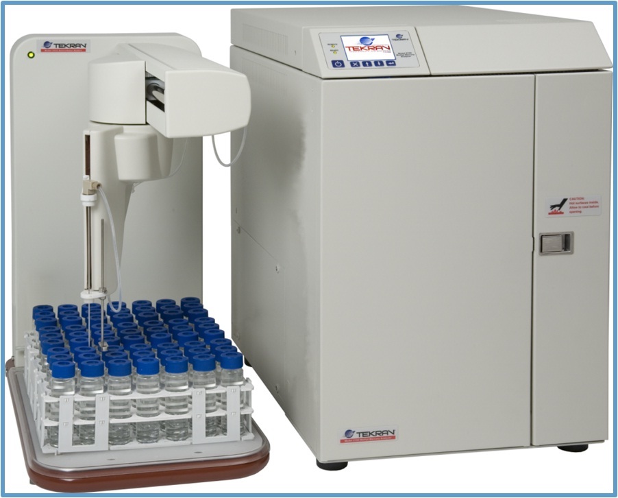
美国安普科技中心为您提供《环境水中(类)金属及其化合物检测方案 》,该方案主要用于环境水(除海水)中(类)金属及其化合物检测,参考标准《暂无》,《环境水中(类)金属及其化合物检测方案 》用到的仪器有Tekran 2700 全自动甲基汞分析仪。
我要纠错
相关方案



 咨询
咨询


